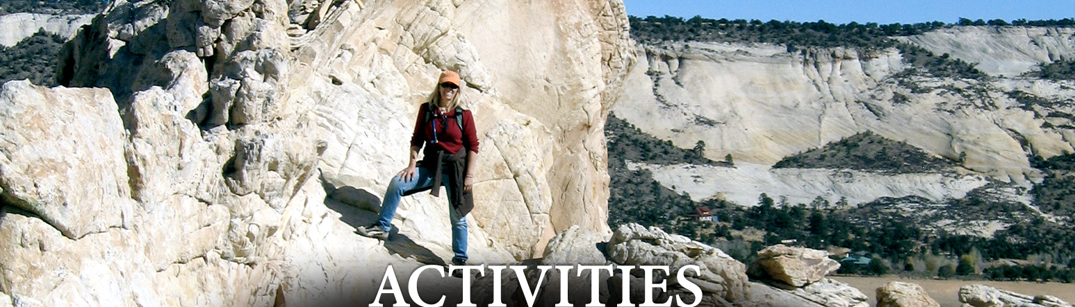
What to Do?
Spend your day horseback riding over desert slickrock. Hike to a 126-foot waterfall. Explore Utah’s wildest, most remote sandstone canyons on a llama or horse-pack trip. Mountain bike, rock climb, go fly fishing, or bird watch from the balcony (our grounds include an eleven acre bird sanctuary). Drive magnificent Highway 12, named one of the top-ten scenic drives in America by Car and Driver Magazine, and the best tour of Utah’s red-rock desert that can be taken in a short trip, a weekend or even a single day by The New York Times.
Or just do absolutely, fabulously nothing.
Simply relax in front of the fire in our cozy common room. Enjoy the luxury of a massage in your room. Dine at award-winning Hell’s Backbone Grill, where the cuisine and service are beyond exquisite. At night, gather with friends around our outdoor stone fire pit or watch the stars from the outdoor hot tub. And feel your mind and soul unwind in this tranquil land of romantic, dramatic beauty.
The possibilities in and around Boulder are virtually endless. Come stay with us and discover for yourself why Boulder, Utah, is the perfect year-round destination.
Questions about an activity or destination not listed here?
Please contact us at (435) 335-7460 or (800) 556-3446, or email us at info@boulder-utah.com
Birding
For great information on the birds in the Boulder area, particularly in the eleven acre bird sanctuary at the Boulder Mountain Lodge, we have many bird books available for loan or purchase. We also have binoculars to check out at the front desk if you want to get a closer look!
Hikes
Inexperienced hikers may want to hire a guide.
NOTE: Due to the rugged nature of the region, some areas are not well maintained or marked. It is always helpful to carry a good topography map and compass, and know how to use them.
 Lower Calf Creek Falls
Distance: 13 miles driving, 6 miles hiking round trip (well marked trail)
Features:Interpretive hike along a creek on route to 126 ft. waterfall. Hiking, fishing, camping, photography
Escalante River (downstream)
Distance: 14.5 miles driving, maximum 67 miles hiking
Features: Deeper flow of the river and extensive side canyons to explore. Hiking, fishing, camping, photography
Escalante River (upstream)
Distance: 14.5 miles driving, maximum 15 miles hiking (easy)
Features: Lightest flow of the river, side canyons to explore, a natural bridge and an arch. The length of the hike is 15 miles but can be shortened to accommodate a day trip. Hiking, fishing, camping, photography
Requires numerous river crossings-your shoes will get wet.
Devil’s Garden
Distance: 22 Miles driving (paved), 13 miles driving (dirt)
Features: Unusual rock formations containing arches. Hiking, picnic area, photography
Horse Canyon
Distance: 19 miles driving (paved), 19 miles driving (dirt), 4 miles hiking
Features: Scenic canyon used for ranching, ranchers road allows car access 13 miles into the canyon, 4WD recommended. 2 mile hike from bottom to Escalante River. Hiking, photography
Little Death Hollow
Distance: 19 miles driving (paved), 13 miles driving (dirt), 7.5-15 miles hiking
Features: Extensive narrow slot canyon, an arch, and petroglyphs. 7.5 miles one way. Hiking, photography
Wolverine Canyon
Distance: 19 miles driving (paved), 10 miles driving (dirt), 5-10 miles hiking (moderate)
Features: Outstanding scenic area with petrified wood. 5 miles one way. Hiking, photography
Dry Fork Slot Canyons (Peek-a-boo & Spooky)
Distance: 22 Miles driving (paved), 28.3 miles driving (dirt), 3-6 miles hiking (difficult)
Features: Very narrow, small slot canyons. Hiking, photography
Fishing
Fishing – Inquire at the front desk for information on obtaining a Utah license if you need one.
 Posey Lake
Distance: 28 miles driving
Features: Alpine lake, stocked with trout. Fishing, hiking, camping, mountain biking
Lower Bowns Reservoir
Distance: 19 miles driving (paved), 4 miles driving (dirt)
Features: Large lake, stocked with trout. Fishing, hiking, boating, camping, mountain biking
King’s Pasture Reservoir
Distance: 7 miles driving (paved), 5 miles driving (dirt), very short hike
Features: Alpine Lake, stocked with trout. Fishing, hiking, camping, mountain biking
Garkane Reservoir
Distance: 7 miles driving (paved), .5 mile driving (dirt)
Features: Easy access reservoir where everyone catches a fish. Fishing
Deer Creek Reservoir
Distance: 6.5 miles driving
Features: Flowing creek at the bottom of a scenic red rock canyon. Fishing, hiking, camping
Calf Creek
Distance: 13 miles driving
Features: Spring fed at the bottom of a scenic red rock canyon. Fishing, hiking, camping.
Other Recreational Activities
Mountain Biking:
Many people like to bike on the scenic Burr Trail and Highway 12.
Nearby Rides:
Routes in Bryce Canyon Area
Mytoge Mountain Trail
Powell Point
Horseback riding
Boulder Mountain Trails offers two hour to multi-day horse pack trips through some of the most scenic and wild country in the great American Southwest.
Llama Trekking & Hikes
Llama trekking and wilderness hiking in Southern Utah.
Outdoor Survival
Boulder Outdoor Survival School (BOSS) is one of the world’s oldest and largest traditional living skills/survival schools. They offer an active outdoors experience and teach traditional primitive methods.